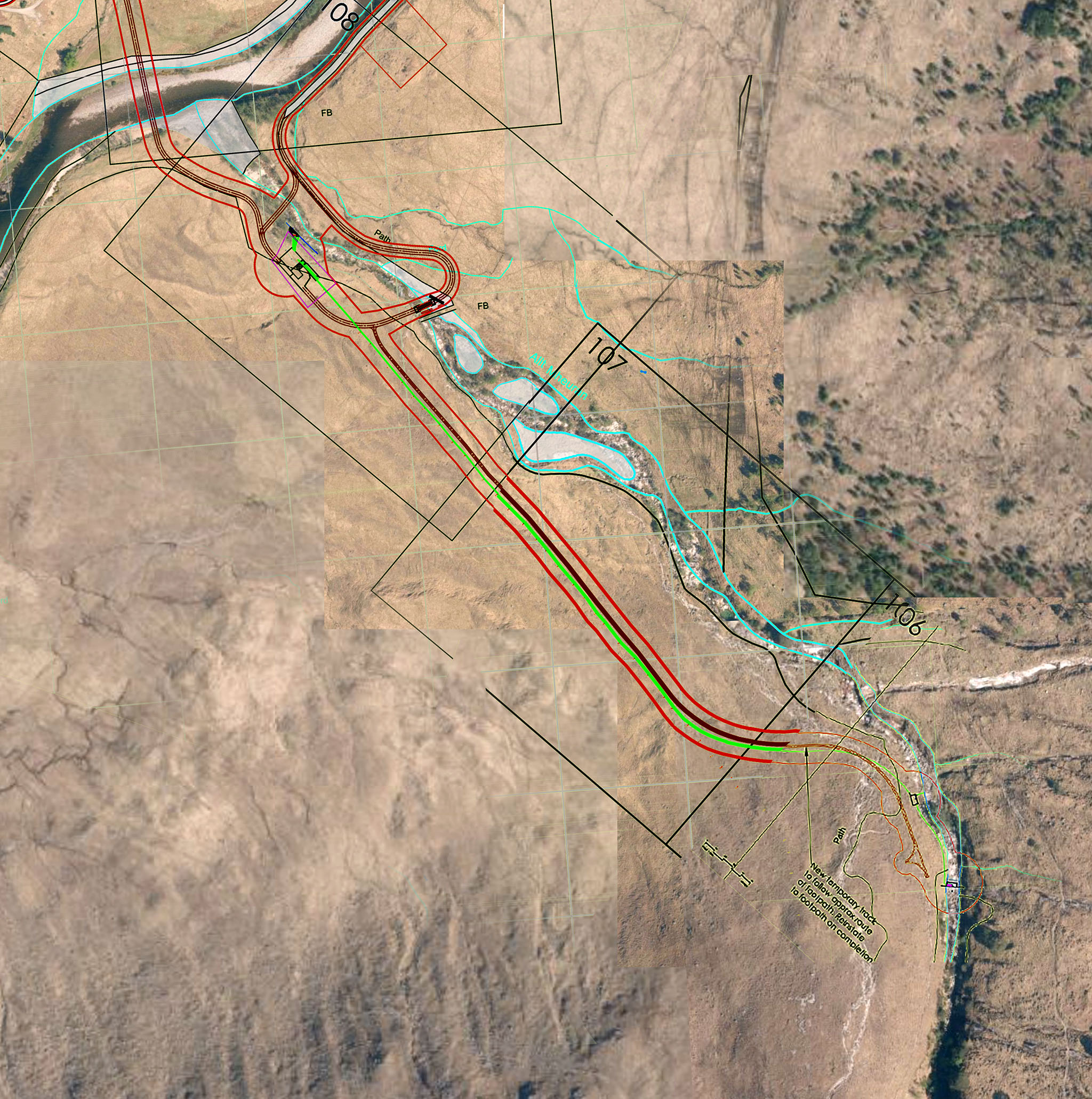
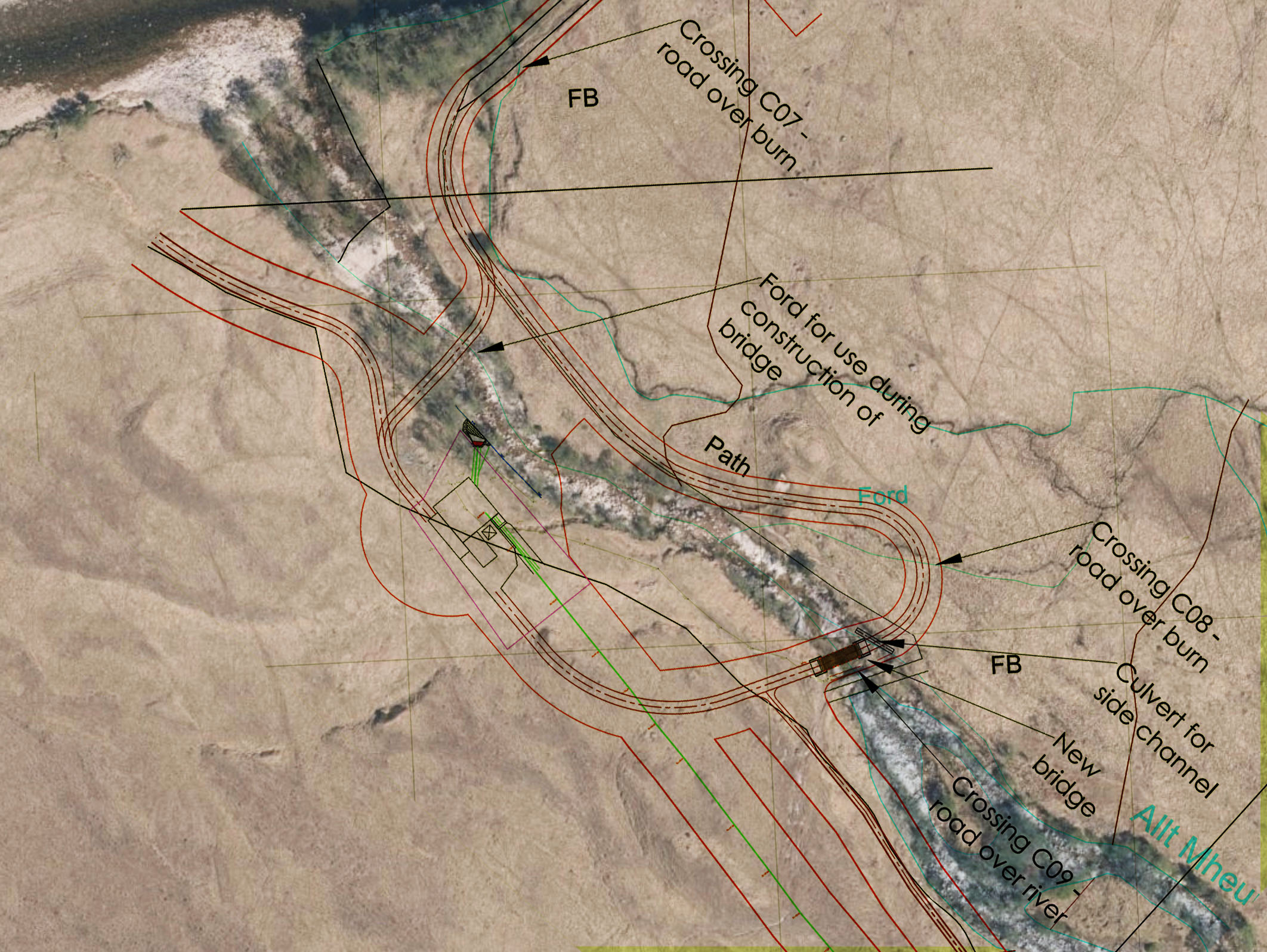
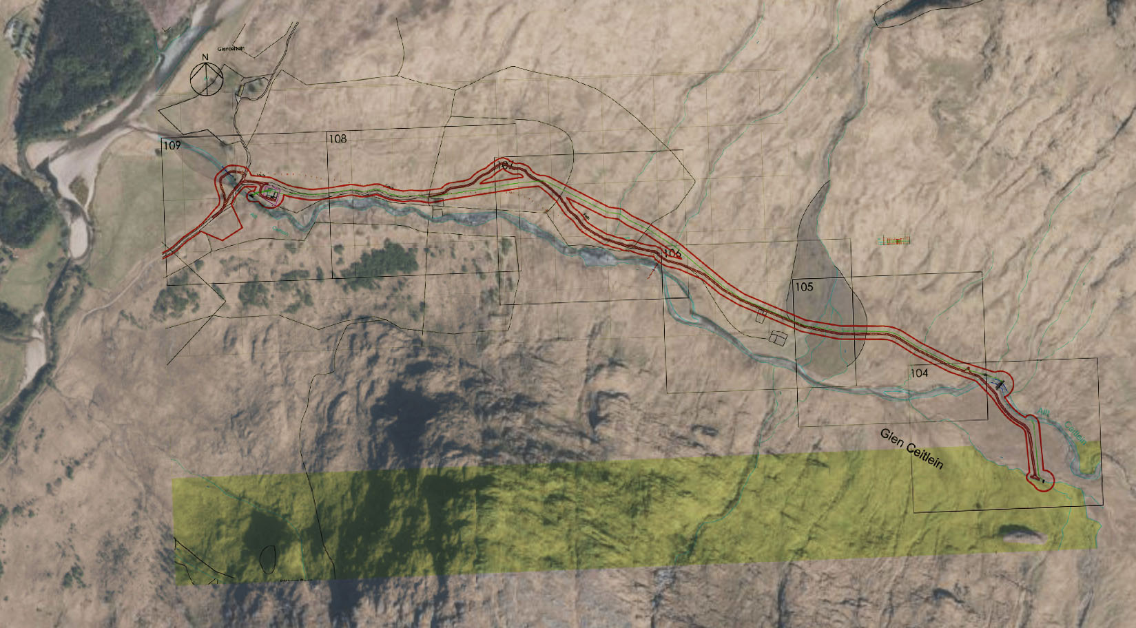
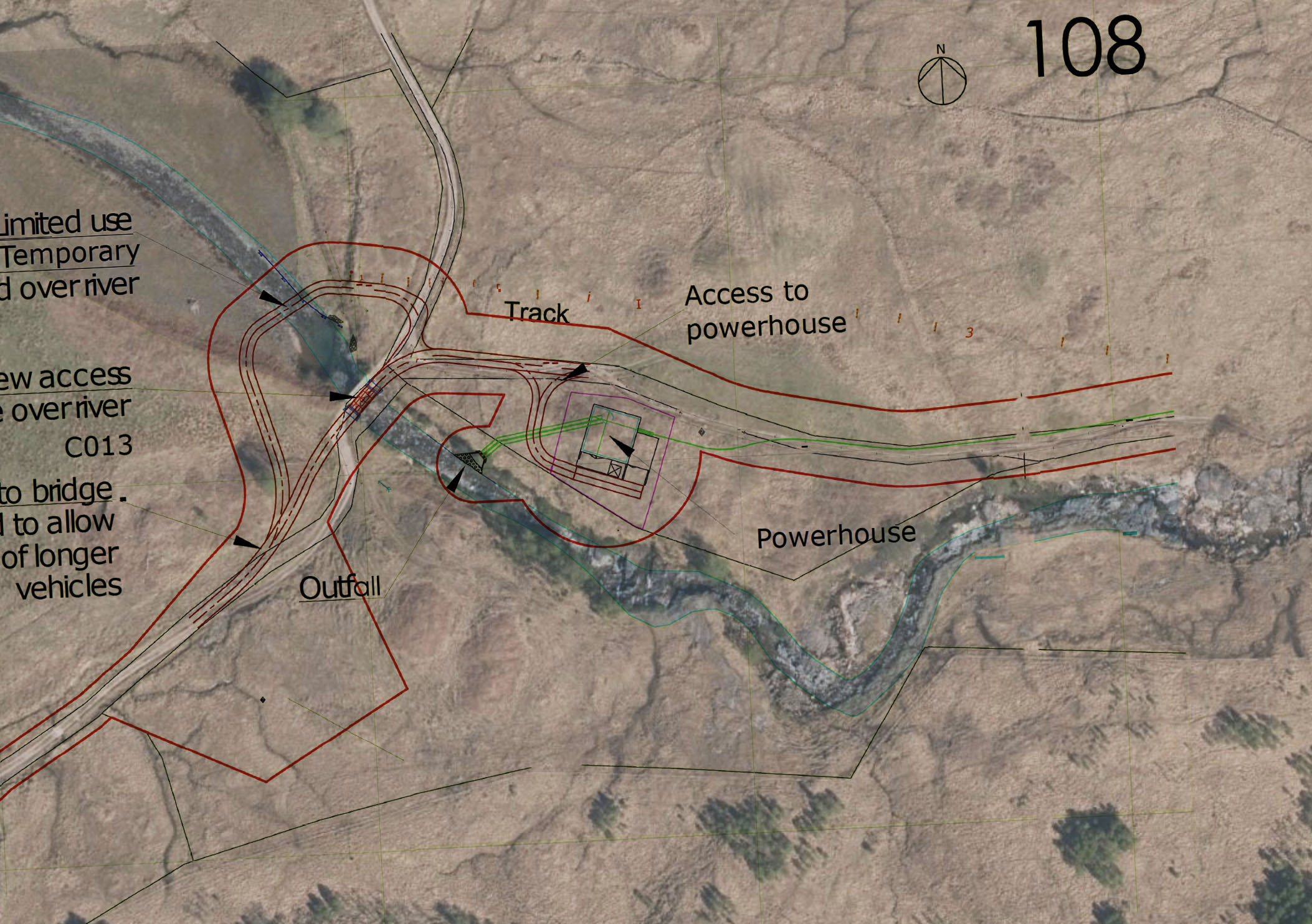
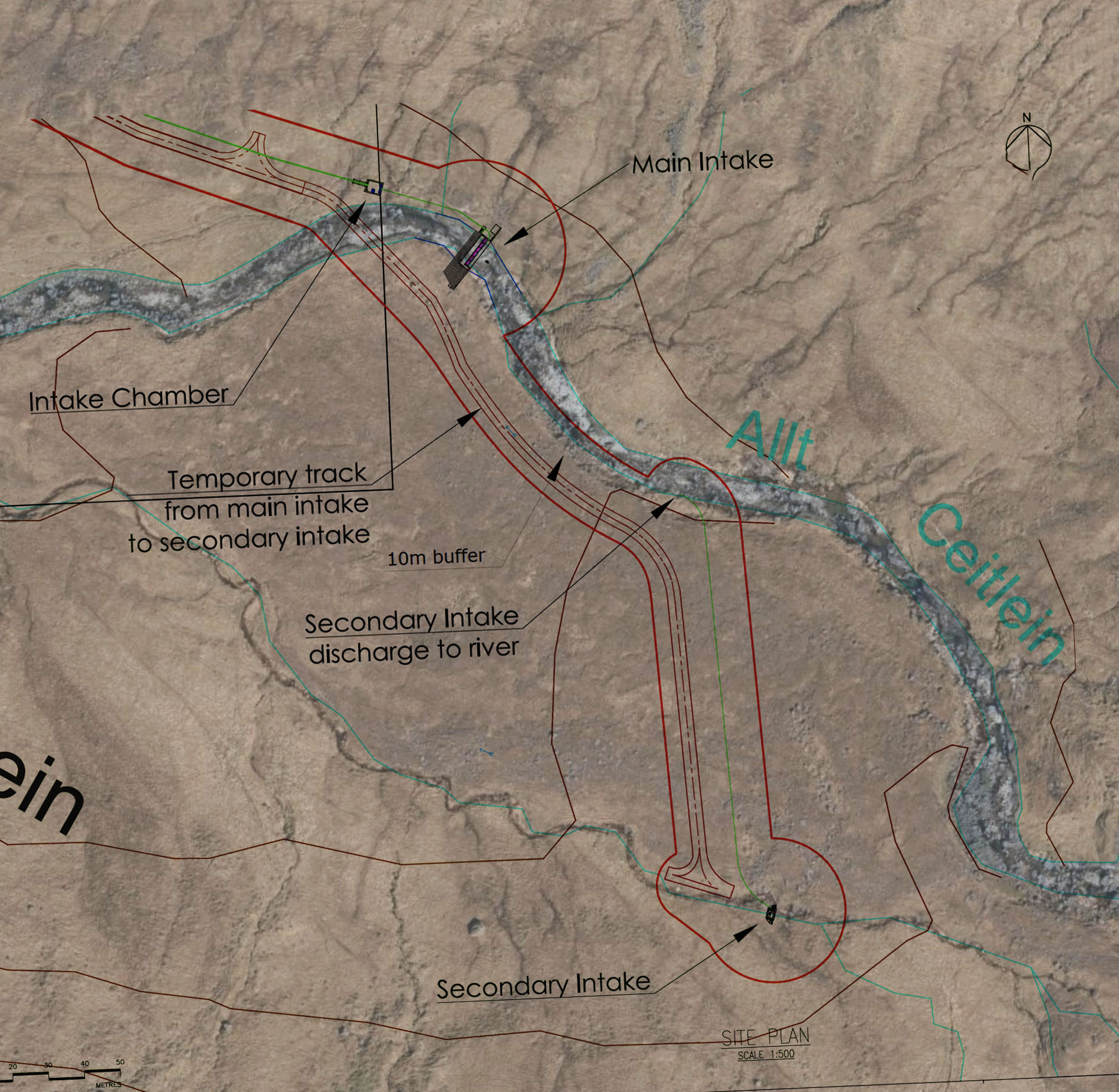
Maps and Video
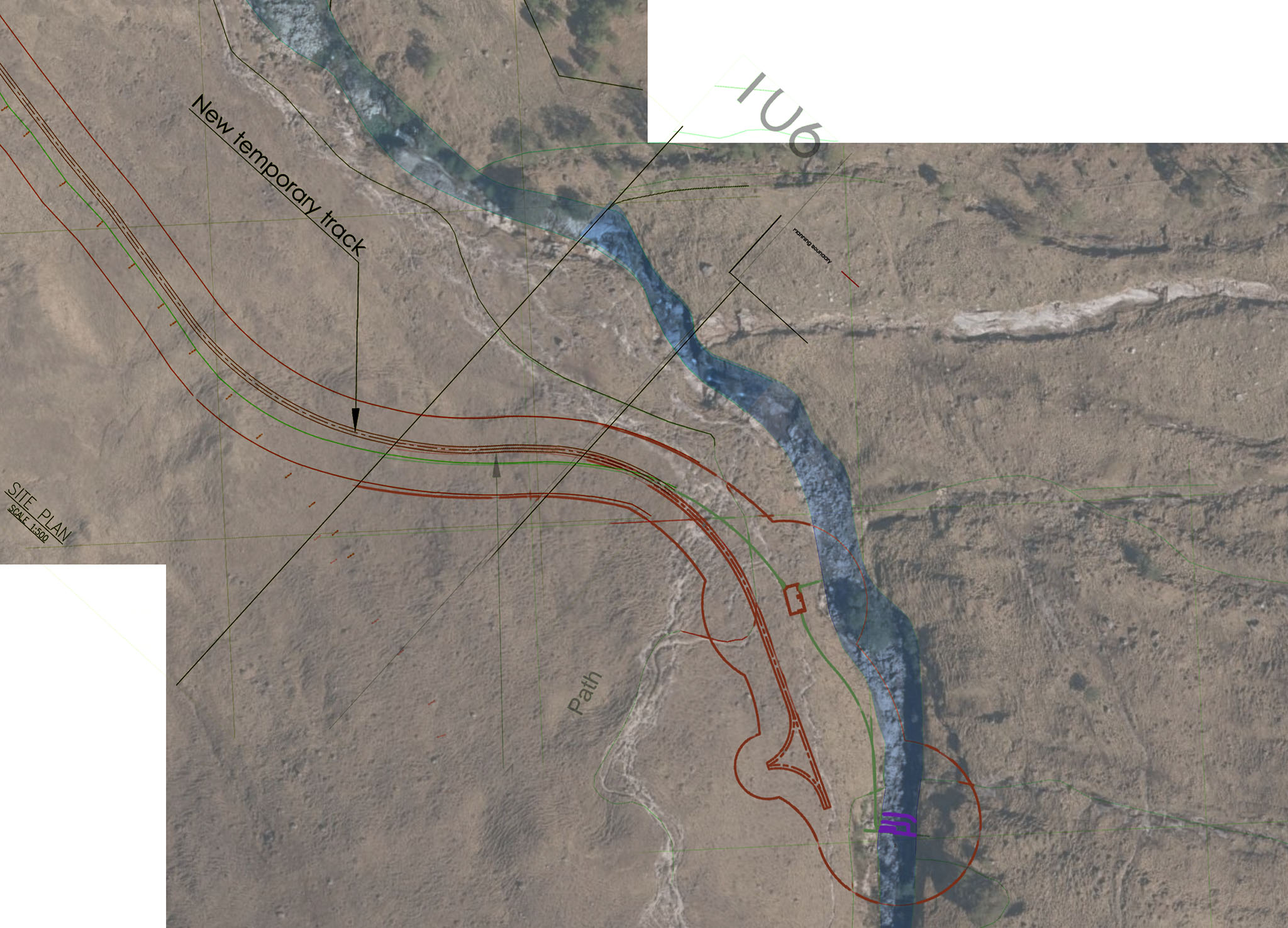
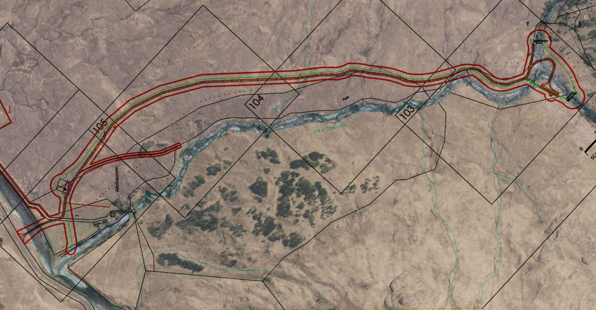
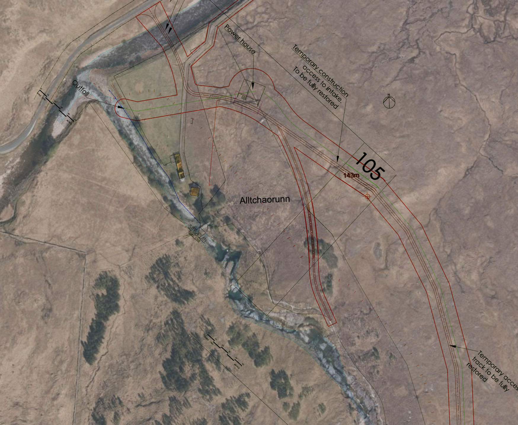
The following show the routes of the three schemes overlayed on top of Ordnance Survey aerial photography
Allt Mheuran
Allt a’ Chaorainn
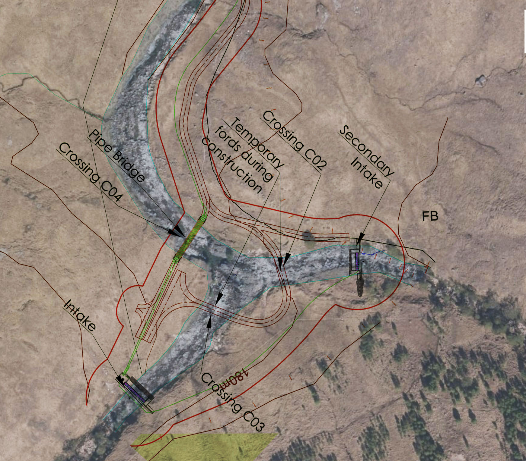
Allt Ceitlein.
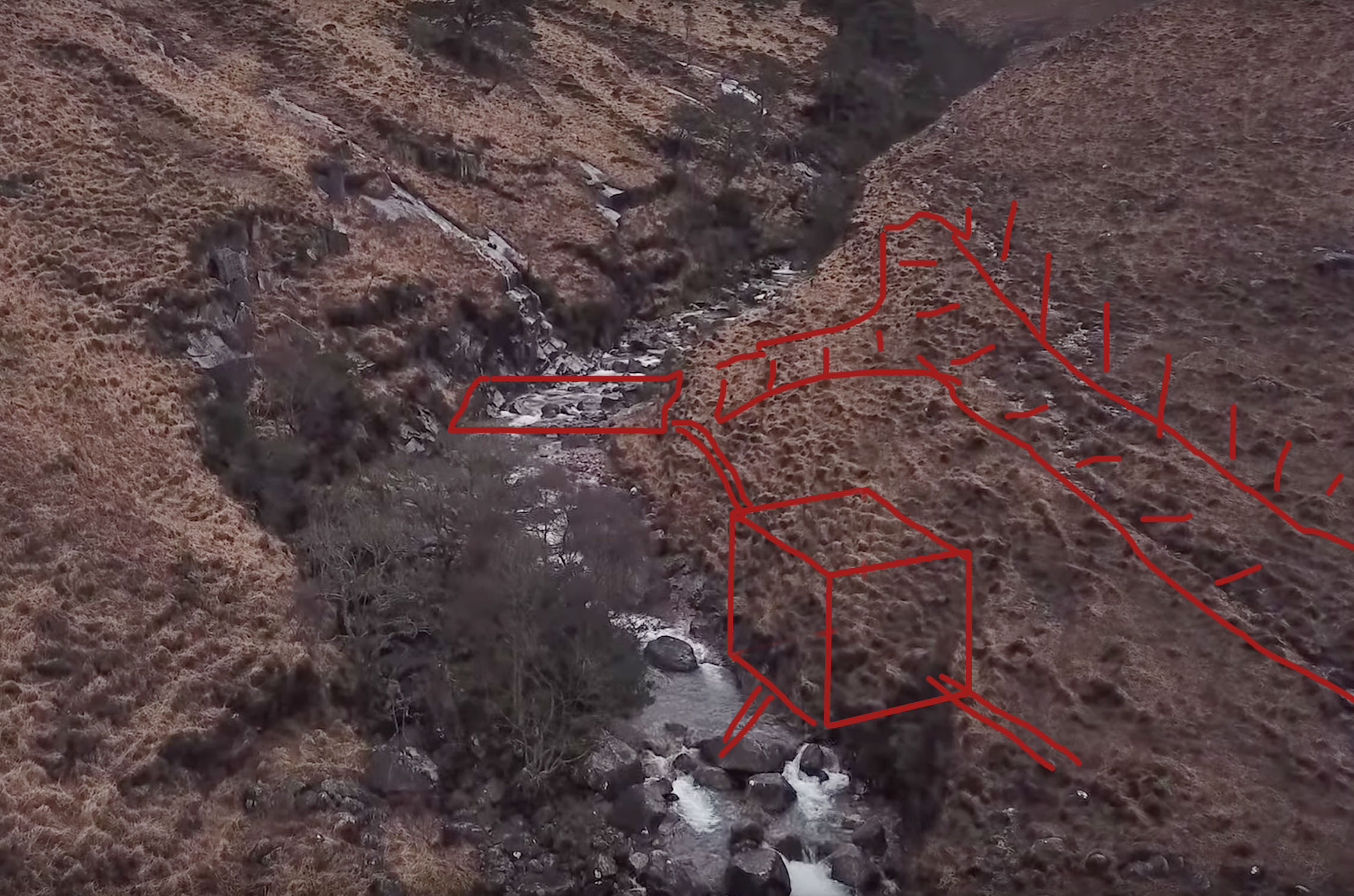
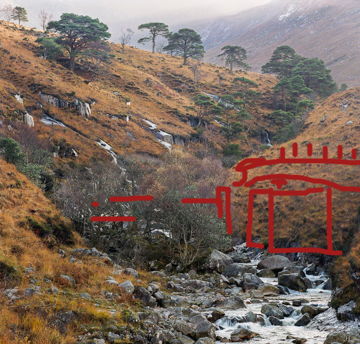
Annotated Photographs
The following are a couple of annotated photographs of the Allt Mheuran scheme